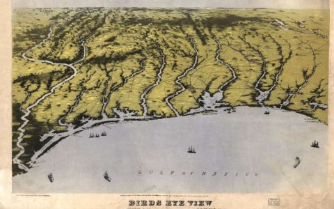
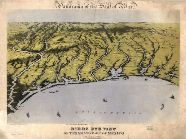
Panorama of the seat of war, with a bird’s eye view of Texas and part of Mexico in 1861. This shows the coastline of the Gulf of Mexico from Louisiana to the Rio Grande River.
Recently a batch of rare Civil War maps were released by the Library of Congress, with many showing what Texas dealt with during the War Between the States.
Texas’ Gulf Coast locale meant that places like Galveston, Corpus Christi, Aransas Pass and Port Lavaca were much in demand during the war over state’s rights and slavery. A federal blockade of the Texas coastline remained in place for most of the war.
In early 1861 Texas Governor Sam Houston had argued against a war and wanted no part of it for his state. He didn’t think it would solve a thing and would only bring bloodshed. He wished for a peaceful resolution instead and turned away from calls for secession.
Even still, early Texans were headstrong and in Feb. 1861 voted to quit the Union, the seventh state to do so. Texas had only been a part of the United State for just over 15 years. Houston ended up retiring back to Huntsville after secessionists declared his office vacant. He refused to declare allegiance to the Confederacy.
He later died in the summer of 1863.
Soon a Texas militia group seized the federal military headquarters in San Antonio. Texas and Southern forces now in essence owned 10 percent of federal firepower.
By the end of 1861, some 25,000 Texas residents were in the Confederate army, with most in the horse-bound cavalry. By the end of the war, it’s believed that 70,000 Texans fought.
The Battle of Galveston in 1862 saw a small Union fleet attacked by Confederate forces near Fort Point. The Union fought back and ended up taking the city of Galveston back for the U.S., only to lose it by New Year’s Day 1863.
The largest battles of the Civil War were fought far away from the state of Texas, and many Texans died a long from home. However, the state didn’t suffer as many casualties as others farther east would.
The war was over by the summer of 1865, with federal control coming back in June of that year. Some Confederates, afraid of Union blow back, escaped to Mexico. The U.S. flag once again was flown in Austin on June 25. Soon a painful Reconstruction of the Union would begin all over the country.
In March 1870, the U.S. Congress readmitted Texas into the Union, although the state did not meet all the formal requirements needed for readmission.
MORE PHOTOS
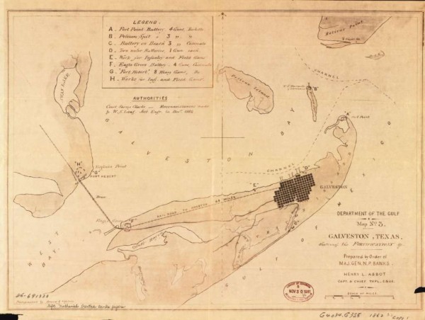
Galveston, Texas, showing the fortifications during the Civil War from 1861 until 1865. Covers Galveston area, west to southeast, from Swan Lake to Gulf of Mexico, and north to Bolivar Point.
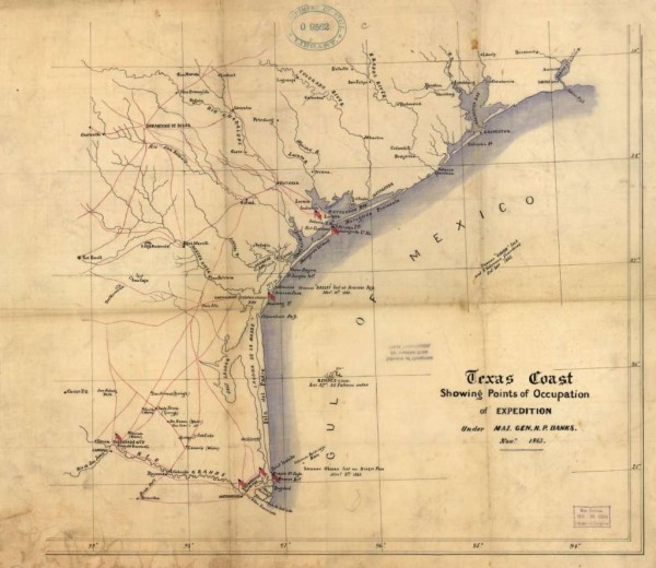
Texas Coast showing points of occupation of expedition under Maj. Gen. N.P. Banks in November 1863. This shows towns, rivers, roads, selected shipwrecks, and Civil War “points of occupation” marked by U.S. flags.
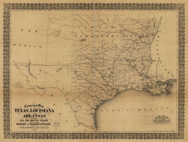
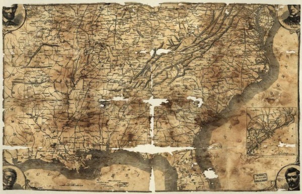
This is a campaign map of Texas, Louisiana and Arkansas, showing all the battle fields and also the marches of Walker’s Division from 1861 until 1865. Map includes names and boundaries of counties, existing and projected railroads, geographic coordinates, drainage, and towns.
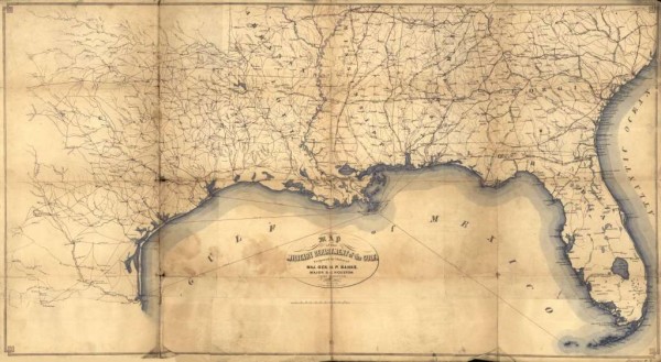
This is a map from the military Department of the Gulf, covering South Carolina, Georgia, Florida, Alabama, Mississippi, Arkansas, Louisiana, and eastern Texas, circa 1864.
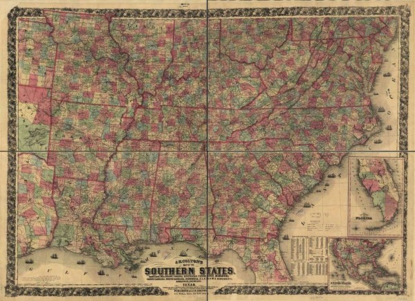
This is J.H. Colton’s railroad and county map of the Southern states containing the latest information in 1864. It features Galveston in an inset map.
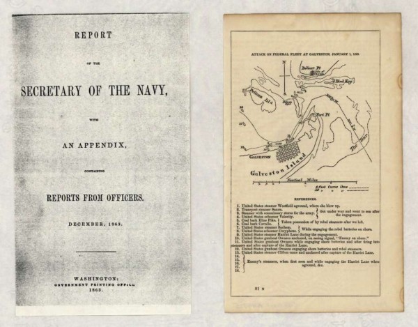
This is a map of an attack on a federal fleet at Galveston, January 1, 1863. Some eighteen positions of ships are listed in “references” and are keyed by number to the map.
rom 1861, a map of the Southern states, includes rail roads, county towns, state capitals, county roads, the southern coast of Delaware to Texas and the harbors, inlets, forts and position of blockading ships.
–chron.com