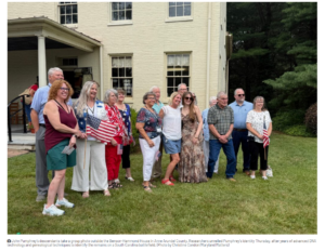
SOUTH CAROLINA: S.C. Battlegrouund Preservation Trust Gets Federal Grant For Liberty Trail Project
CHARLESTON, S.C. — History isn’t always easy to access or appreciate. We catch glimpses of it, consider certain episodes, sometimes engage in conversations about its meaning and influence. But generally it remains distant, obscured by contemporary life.
The South Carolina Battleground Preservation Trust and its partners plan to bring the state’s Revolutionary War history alive though reality technology and a $250,000 grant from the National Park Service to help kickstart the effort.
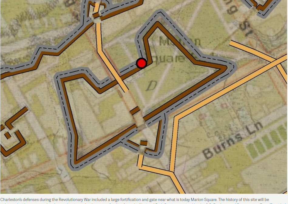
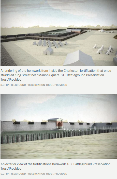
The first project on the list is the 18th-century fortification that was located at what is today Marion Square. This was the gate to the city, 30 feet tall and 600 feet wide, with cannons lined across the top to defend against the British.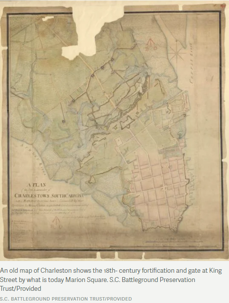
A 12-foot-long remnant of the tabby hornwork remains on the site, but the information available is minimal and leaves passersby with no idea of what was once there, said Doug Bostick, executive director of the S.C. Battleground Preservation Trust.
Augmented reality can change that, he said. And it has the potential to generate interest in American history among young people.
The new technology is part of an effort to interpret history at several sites that are part of the Liberty Trail, a network of Revolutionary War-era places secured preserved by the Trust in partnership with the American Battlefield Trust.
For the Charleston project, Bostick has been working with scholars such as Carl Borick, director of the Charleston Museum; Nic Butler, a historian with the Charleston County Public Library; and John Marcoux, director of the Graduate Program in Historic Preservation, a collaboration between Clemson University’s School of Architecture and the College of Charleston.
The Trust currently is on the hunt for technology vendors to build the augmented reality applications that would make these past events and spaces electronically visible today.
Ground-penetrating radar has revealed the precise footprint of the old fortification, and that in turn will enable programmers to recreate the structure virtually. Visitors to the site can access the feature via the Liberty Trail website, or perhaps through a specially developed app on their smartphones and tablets, then hold up their devices to understand what the area looked like in the 1770s and 1780s.
“You’ll be able to see it,” Bostick said.
Visitors might be able to spot Gen. William Moultrie and Maj. Gen. Benjamin Lincoln standing atop the gate watching British troops advance toward the city. They will be able to imagine Patriot fighters at their surrender on May 12, 1780, marching out through the gate and laying down their arms about where the restaurant Virginia’s on King now stands.
And they’ll be able to visualize the British retreat on Dec. 14, 1782, when the Siege of Charleston came to an end.
“It’s a critically important place in the history of Charleston, and to actually be able to see this fortification and see the gate of Charleston — we think will be an extraordinary experience for people,” Bostick said.
Another site that will see an enhancement thanks to augmented reality is Fort Watson, north of Santee, just off Interstate 95. There, the British built a palisade fort atop an old Native American mound.
On April 15, 1781, Continental Army forces under the command of Henry “Light Horse Harry” Lee and South Carolina militia leader Francis Marion, launched an attack.
The initial effort failed, but the attackers then constructed a tower for sharpshooters who at an elevated height could fire into the fort. The barrage from the tower forced a British surrender.
 “Now more than ever, we know how modern technology can bring people together,” National Park Service Deputy Director Shawn Benge said in a statement. “Harnessing powerful stories at these battlefields and sites of armed conflict can open our eyes to the lessons from the past and lead us to greater understanding of our shared history.”
Other sites likely to get the augmented reality treatment include Fort Fair Lawn in Moncks Corner and the site of the Battle of Eutaw Springs.
Several years ago, when Bostick and his team first were dabbling in augmented reality technologies, he showed his 20-year-old son Taylor virtual renderings of the Union ironclad Keokuk guns located at The Battery in Charleston.
“Dad,” Taylor said, “you’re finally doing something that’s cool.”
History isn’t always easy to access or appreciate. We catch glimpses of it, consider certain episodes, sometimes engage in conversations about its meaning and influence. But generally it remains distant, obscured by contemporary life.
The South Carolina Battleground Preservation Trust and its partners plan to bring the state’s Revolutionary War history alive though reality technology and a $250,000 grant from the National Park Service to help kickstart the effort.
The first project on the list is the 18th-century fortification that was located at what is today Marion Square. This was the gate to the city, 30 feet tall and 600 feet wide, with cannons lined across the top to defend against the British.
–postandcourier.com
###