MECHANICSBURG, Pa.— Civil War and More Bookstore in Mechanicsburg has books for adults and children, as well as music, souvenirs, some model ironclads, and maps. Many of the maps owner Jim Schmick sells are replicas of charts drawn up during the Civil War.
One of these was created by Jedediah Hotchkiss, staff cartographer for Confederate General Stonewall Jackson. Oddly enough, he wasn’t originally a Southerner.
“He is from the Binghamton, New York area,” Jim Schmick said. “And one of his first jobs was as a school teacher around Lykens, teaching the coal miners’ kids. So as a hobby, he taught himself cartography and drawing of maps. And he mapped out the Cumberland down into the Shenandoah Valley.”
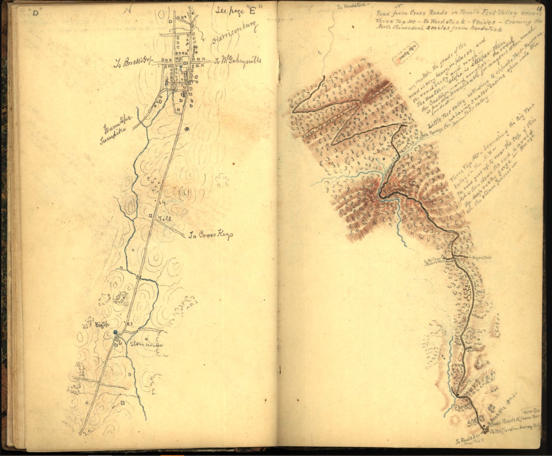
Page from Hotchkiss Sketch Book Detailing a Mountain Pass
Library of Congress
He eventually moved to the Shenandoah Valley in Virginia, where he continues to teach and draw maps.
When the Civil War broke out, he sided with his adopted state of Virginia. His mapmaking abilities soon attracted the attention of General Thomas J. “Stonewall” Jackson, commander of the Second Corps of the Army of Northern Virginia.
In a sense, the story of Hotchkiss’s Pennsylvania map starts in Maryland. On September 17th, 1862, Robert E. Lee’s first attempt to carry the war into the North got stopped at the Battle of Antietam.
“This was the bloodiest single day of the Civil War. Overall casualties exceeded 22,000 dead, wounded, and missing, which was just unprecedented. It was definitely a bloodletting on the scale of which the United States had not yet seen,” Dr. Christian B. Keller, Director of the Military History Program at the Army War College said.
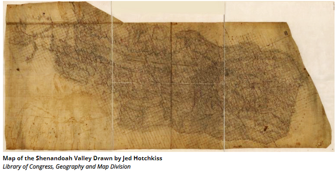
Undaunted by their failure, Lee and Stonewall Jackson soon begin planning another invasion for 1863. On February 23, 1863, Jackson ordered Jed Hotchkiss to start work on a map of Pennsylvania.
The map Hotchkiss created now resides at the Handley Library in Winchester, Va. It’s part of the collection of the Stewart Bell Jr. Archives, located in the library’s basement. It received extensive conservation in the 1980s, and now sits in a special conservation frame and matting, with special glass to protect it from ultraviolet light. Usually, it’s also covered with a black cloth, but they brought it out so we could see and photograph it.
“This was meant to be a theater map, which would show Jackson the whole area of potential conflict,” Lorna Loring, an Archive Associate said.